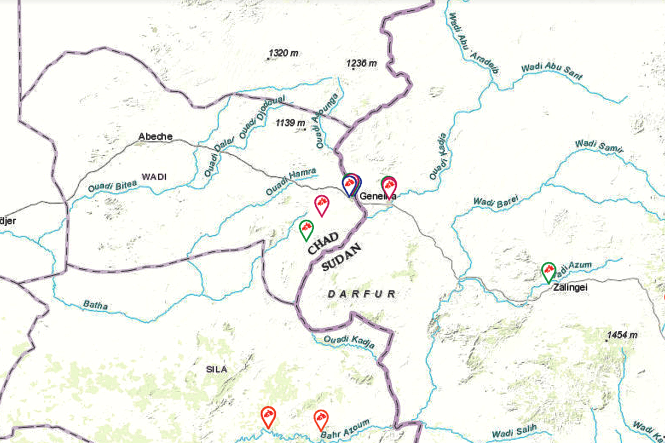
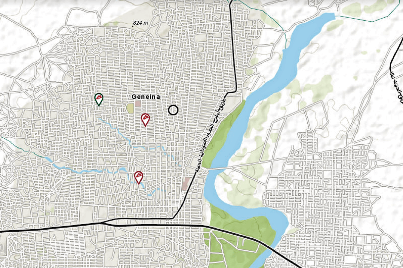
The 20-mile journey from El Geneina, capital of Sudan’s West Darfur state, across the Chadian border to Adré has become a common escape route for people fleeing the violence that has gripped the city for nearly a year.
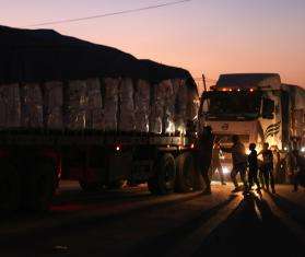
After the Sudan conflict erupted in Khartoum last April, El Geneina quickly became a flashpoint in the fighting, and ongoing instability continues to send civilians in droves to neighboring Chad—including those from the Masalit community fleeing targeted ethnic violence. Most refugees and returnees are living in sprawling camps in the desert, where access to water, food, and basic health care is scarce. Doctors Without Borders/Médecins Sans Frontières (MSF) teams are on the ground providing medical care and humanitarian aid, but the needs remain immense.
Mapping remote locations is key to responding effectively to humanitarian emergencies like these. That’s why MSF and our Missing Maps volunteers are holding a virtual Mapathon on Thursday, February 29 at 6 p.m. to map areas around El Geneina and Adré. Whether you are a beginner or an experienced mapper, all are welcome for this virtual mapping party.
Why maps?
Despite the immense needs accumulating in this region, critical parts are largely unmapped. MSF has long struggled with a lack of freely accessible mapping data. Many of the world’s most vulnerable people live in communities that have never been mapped. This makes it challenging to reach communities and fully understand the scope and character of regional health risks. Camps for displaced people are particularly challenging.
“Camps are not a static thing," says Jean-Guy Adeoud, a geographic information system (GIS) specialist with MSF known as “the map man.” “They live, they evolve like human beings,” changing in shape as people come and go.
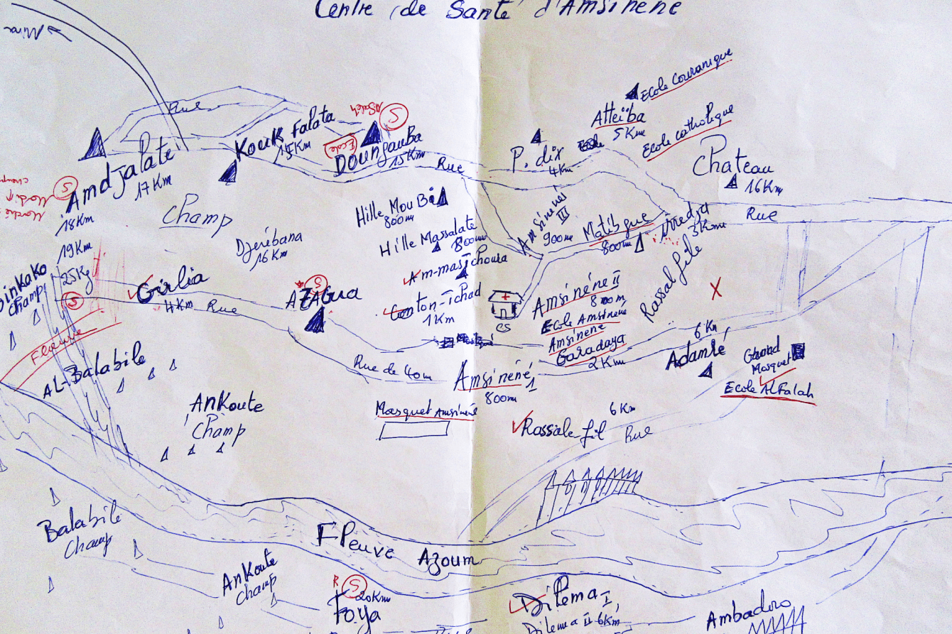
Accurate map data is essential for epidemiology, logistics, and resource allocation in a humanitarian response. Previously, in many unmapped regions our teams had to rely on hand-drawn maps and local guides to find villages and settlements not represented on commercial maps. By crowdsourcing map data, the Missing Maps project helps make MSF’s work more efficient and effective.
As an example, we mapped Lubumbashi, Democratic Republic of Congo (DRC), so we could pilot a cholera management tool. The idea was to combine the geographical data with patient data from our clinics and produce a dashboard that shows how the area’s frequent cholera outbreaks move, where they come from, and where they’ll go.
“Having proper maps really made a big difference to using our time and resources more efficiently,” says Theresa Berthold, an MSF project coordinator who worked on an emergency response in Chad. “We could plan according to the confirmed locations of villages and draw up our schedule accordingly. With proper maps on their electronic tablets, our surveyors could easily navigate their way to the villages and the selected households—again making the work much easier and quicker.”
How it works
The process is three-fold:
- First, you take satellite or aerial imagery of a place and trace features—like roads, buildings, and rivers— based on what the map will be used for.
- Second, you take that newly created data and enter it into OpenStreetMap, an online, searchable map database described as a cross between Google Maps and Wikipedia because it’s created and maintained by its users.
- Third, that data is taken to projects around the world, where local people verify landmarks and add their firsthand knowledge to the data, such as road names, settlements, and administrative divisions—whatever it takes to make that map something we can use to find and help people in need.
Spatial sampling to fill in the gaps
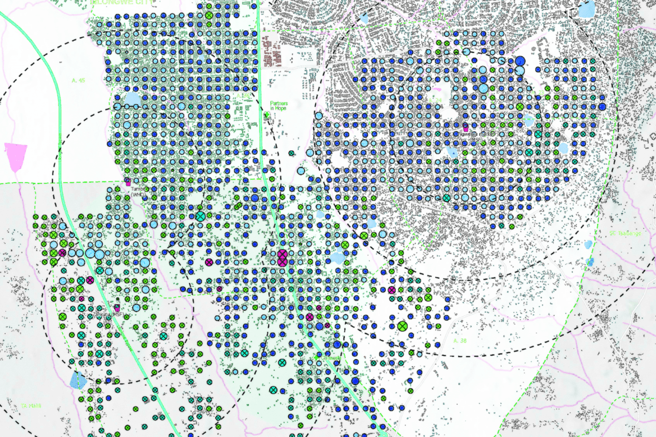
When our teams mapped the camps around Goma, DRC in 2023, we sent two surveyors to visit about 18 shelters per day with a questionnaire to find out how many people live in each camp and information related to their health, the nutritional status of their children, and recent deaths. The information was recorded on mobile devices so that later, the numbers gathered from the sample could be projected to the whole population.
Then the process of spatial sampling began. This involves randomly selecting a specific number of buildings in each camp represented by points on the map and grouping them to help organize a survey of the people living in the camps.
“I was stunned by how many tents had been constructed in such a small area," says Anthaas, who volunteered to help Missing Maps. "With more and more tents mapped, I got more comfortable with the precision and speed of the mapping. The overwhelming feeling that I am sitting comfortably at home and mapping this area remotely, while people there are forced to live completely different lives, is still with me.”
Putting maps to humanitarian use
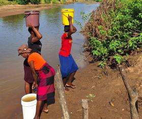
While the primary impact of geodata on MSF health interventions has been on the estimation of populations, understanding the levels and causes of mortality and facilitating learning within the organization, the data is also available for other humanitarian organizations. This helps increase awareness and aids in mapping life-saving decisions, such as where to provide new water and sanitation points or health care for those who need it the most.
We have seen the results in places including DRC, where mapping makeshift camps has helped us build vital water and sanitation infrastructure and deliver humanitarian aid; and in Malawi, where we launched an emergency response when Cyclone Idai hit in 2019 with the support of our Missing Maps teams who began mapping roads, buildings, and water drainage systems just after the storm made landfall. And in Am Timan, Chad, we successfully carried out a measles vaccination campaign with the help of 221 volunteers who mapped 34,120 buildings and created a detailed map of the city and its surroundings in just four weeks.