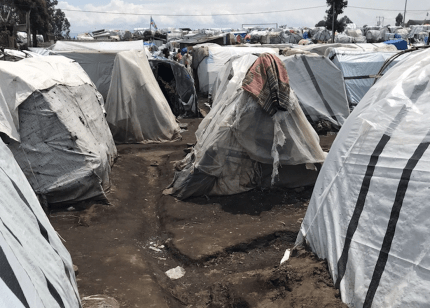
Very few of the one million people displaced by the recent violence in North Kivu, Democratic Republic of Congo (DRC), dare to return. Many live in temporary camps on the outskirts of the capital city of Goma, where people often lack shelter, food, clean water, and toilets, and are exposed to the risk of disease and high rates of sexual violence. Part of the difficulty of responding to the needs in these areas is that there are often no maps of the displacement camps or recent, accurate data on the number of people living there.
To address mapping gaps, Doctors Without Borders/Médecins Sans Frontières (MSF) and partners launched Missing Maps, a special initiative powered by volunteers around the world. Using OpenStreetMap (OSM)—an open, free, and crowd-sourced platform—volunteers map underserved areas like the camps around Goma in order to provide geographic data to international and local nongovernmental organizations so they can better respond to crises.
Filling in the gaps with geodata
From late March to July 2023, Missing Maps volunteers used OSM to review satellite imagery and mark over 65,000 displaced people’s shelters, as well as buildings in host communities. They also identified nearly 800 existing buildings in six sites near Goma, including Lushagala, Bulengo, Kashaka, Rusayo, Don Bosco, and Nzulu. It’s difficult to establish a water and sanitation system or a vaccination campaign without recent, accurate data on the size of the area or the number of people living there. Geodata is an effective tool because it can be used to estimate population sizes, mortality rates, and other important figures for health interventions.
As part of the Missing Maps initiative, MSF teams also conducted surveys in each of the displacement sites to estimate the population and mortality rate—the latter by logging causes and locations of deaths in the community.
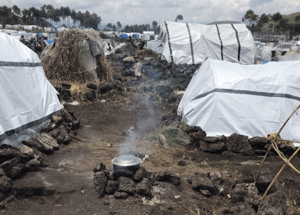

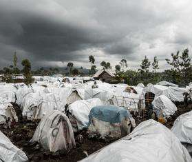
In camps around Goma, residents live in temporary shelters made of wooden poles and plastic sheeting. DRC 2023 © MSF
Surveying the camps of Goma
After the camp shelters around Goma were mapped, the process of spatial sampling began. This involves randomly selecting a specific number of buildings in each camp represented by points on the map and grouping them to help organize a survey of the people living in the camps.
“I was stunned by how many tents had been constructed in such a small area," said Anthaas, a mapper. "With more and more tents mapped, I got more comfortable with the precision and speed of the mapping. The overwhelming feeling that I am sitting comfortably at home and mapping this area remotely, while people there are forced to live completely different lives, is still with me.”
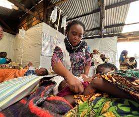
MSF survey teams. DRC 2023 © MSF
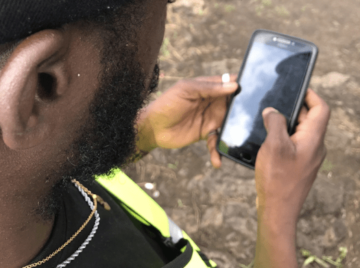
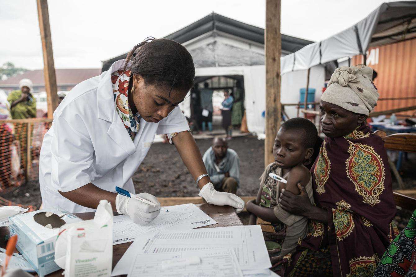
A team of two surveyors visited about 18 shelters per day with a questionnaire to find out how many people live in each camp and information related to their health, the nutritional status of their children, and recent deaths.
Next, an MSF survey team visited the region to confirm the location and use of the buildings and settlements identified by volunteer mappers. They made their way through the camps, identifying toilet facilities, water collection points, and more.
Challenges of mobile data collection
While interviewing residents, the survey team recorded the information on mobile devices so that later, the numbers gathered from the sample could be projected to the whole population. After field data collection, the MSF public health data analyst and the geographic information systems (GIS) specialist reviewed the data. The team then calculated the population of the camp by multiplying the number of people living in each hut surveyed in the sample.
“We realized there was a shift from the satellite imagery to reality,” said Georgios Karanapagos, MSF public health data analyst. “The initial training assumed that the [existing] map was perfect, the reading from the mobile device was perfect. However, the mobile devices proved to have limited precision. There could be an offset of about 21 feet, so one dot on the screen could be matched to three different huts.”
Using geodata to respond to outbreaks and epidemics
Epidemiological surveillance data helps MSF monitor and respond to an epidemic. For example, cholera is endemic in North Kivu, where people live in crowded conditions without access to clean water. In March 2023, the situation escalated to a cholera epidemic. Using epidemiological surveillance data, epidemiologists could see whether the epidemic was limited to the camp or whether had spread to the wider residential area. This data helps humanitarian workers prepare rapid response mechanisms, such as the provision of safe water and latrines, as soon as possible.
In addition, retrospective data analysis helps our teams to better understand the characteristics of an epidemic, such as how quickly it spreads, who it affects, and the impact of the humanitarian response. This helps us respond faster and more effectively to the next epidemic and save lives, especially in the early days of an outbreak.
A variety of interventions helped to contain cholera epidemics and reduce the number of cholera cases, including the establishment of cholera treatment centers and basic health services, health promotion programs, the provision of safe water, the construction of bathrooms, and the implementation of a vaccination program.
With cholera epidemics now under control, other health and social issues have come into focus in the camp, including a high number of measles cases due to low vaccination coverage, poor nutrition among children, overcrowded schools, lack of income opportunities, and violence—especially against women.
While the primary impact of geodata on MSF health interventions has been on the estimation of populations, understanding the levels and causes of mortality, and facilitating learning within the organization, the data is also available for other humanitarian organizations. This helps increase awareness and aids in mapping life-saving decisions, such as where to provide new water and sanitation points or health care for those who need it the most.
The Missing Maps Project
Learn moreAbout MSF in DRC
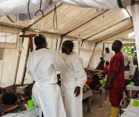
MSF's work in DRC includes responding to the urgent needs of people displaced by recent violence in North Kivu, providing medical care for cholera and measles, free pediatric care and support for survivors of sexual violence, building bathrooms and showers, and delivering clean drinking water.